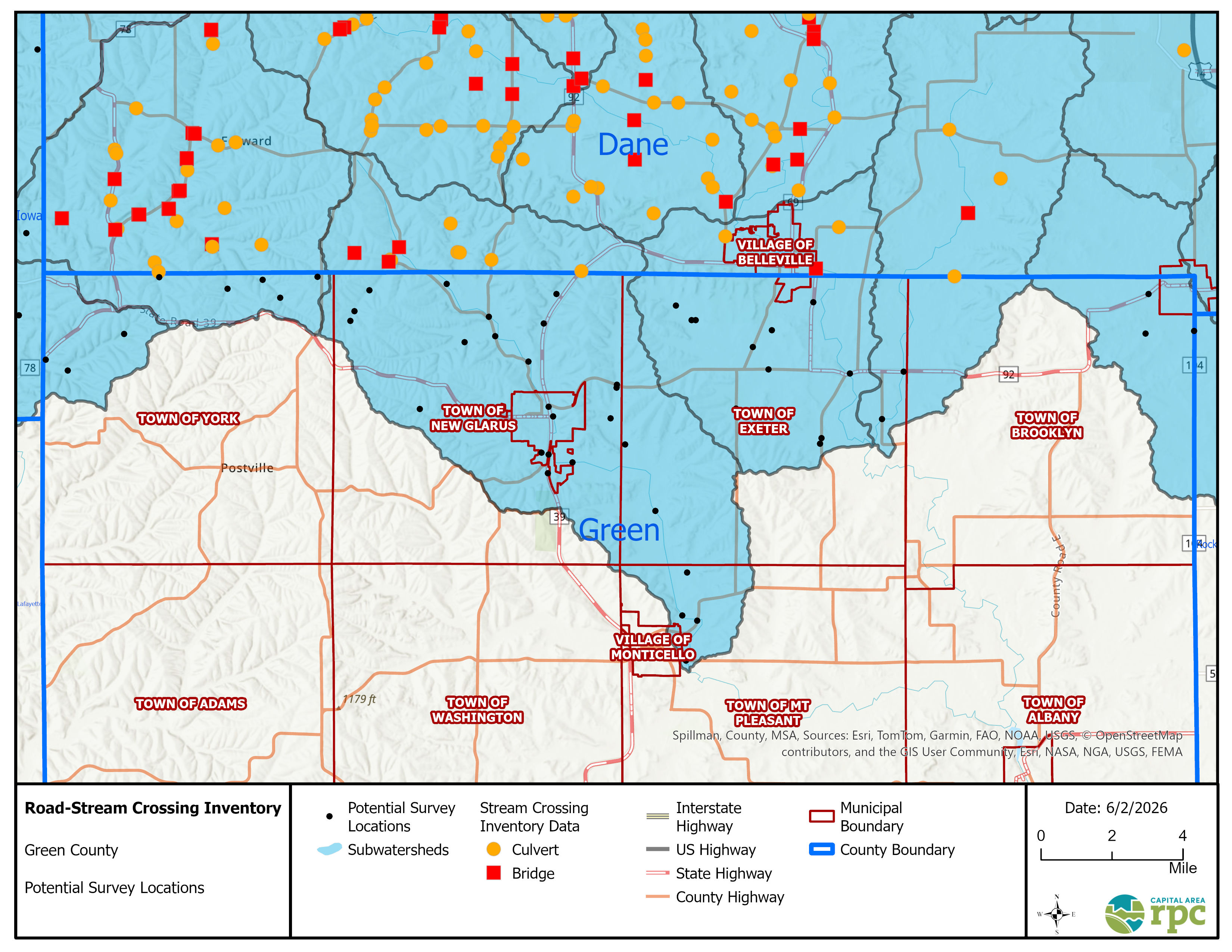
The Capital Area Regional Planning Commission (CARPC) is creating an inventory of culverts and bridges in local and county roads across our region. Heavy rainstorms and flooding events are happening more often and many road-stream crossings (aka culverts and bridges) are not able to handle the increased water flow. This inventory will help local governments prioritize bridges and culverts for replacement, informing local budgets and hazard mitigation plans.
Most of this inventory work is in Dane County, but watersheds don't follow jurisdictional boundaries. CARPC and partner organization Trout Unlimited (TU) are planning to collect data for subwatersheds that extend into the towns and counties around Dane County. We are building this inventory with the Great Lakes Stream Crossing Inventory protocol (read more here: https://great-lakes-stream-crossing-inventory-michigan.hub.arcgis.com). The information collected about structure condition, flood vulnerability, and aquatic passability will also be useful for improving safety and understanding stream connectivity, which can help with future watershed planning. Data collection in your area will occur summer 2026 and data will be published on the public Stream Crossing Dashboard. The attached map shows the potential survey location/s in your municipality.
Please let us know if you would like to meet virtually to discuss the inventory.
Thanks,
Melissa Michaud (Breyer)
ENVIRONMENTAL RESOURCES PLANNER
(608) 474-6020